Aerial Urban LiDAR
Hamish Carr
Urban LIDAR Processing
While most of my research has been in graphics and visualisation, I have also worked on acquiring, processing and visualising urban aerial LIDAR data with my colleague Prof. Debra Laefer (NYU). This work started when I was working at University College Dublin with her, and continued for the best part of a decade.
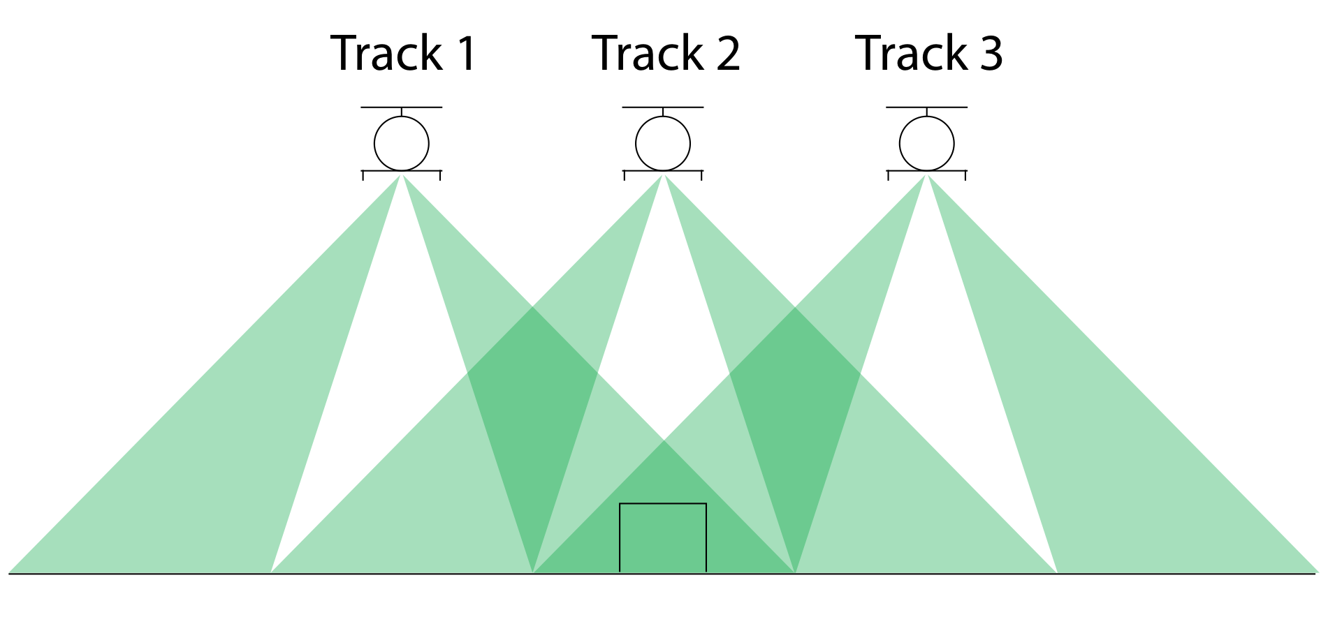
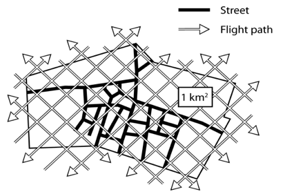
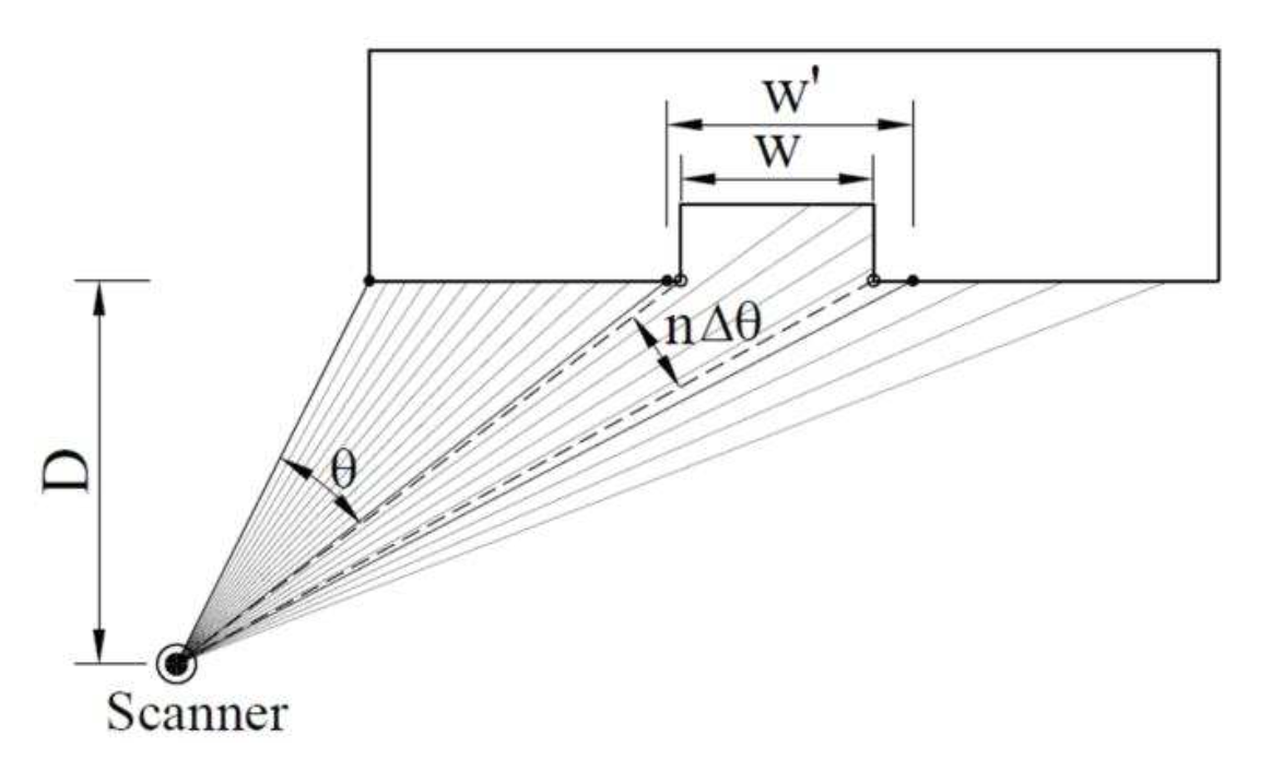
This work covered questions of how to get high-quality dense LIDAR samples from aerial flyovers, a problem we solved with multiple overlapping flight tracks:
 |
 |
|---|
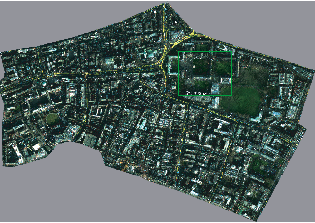
This resulted in a 900 million point cloud representing downtown Dublin. Notice the yellow streaks? Those are the tops of buses as they move around the city.
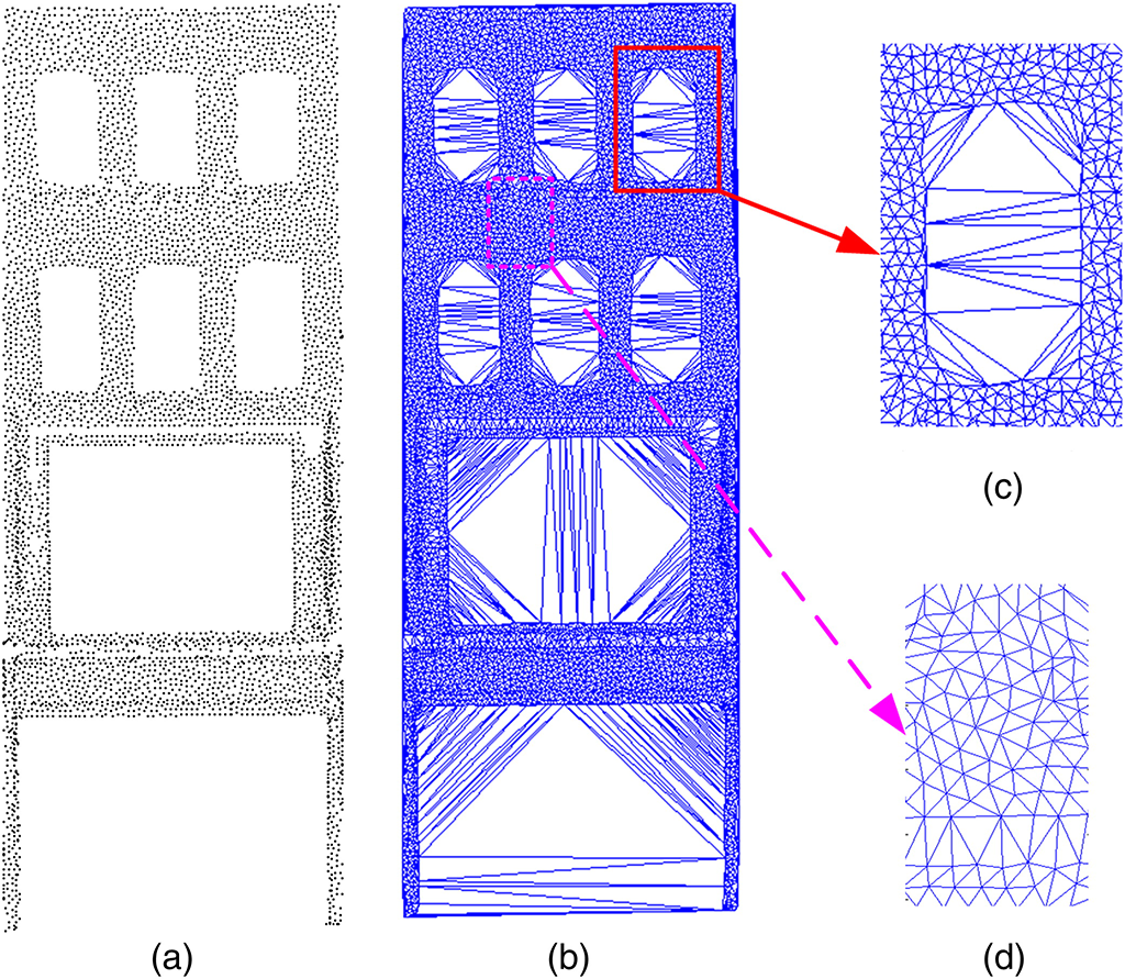
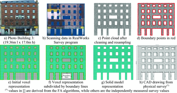
Ultimately, the goal of this research was to create engineering models of the buildings scanned, and we managed to do this by using inverse ambient occlusion to detect buildings, then voxelising the building footprints, which worked surprisingly well, allowing followup work to build more sophisticated models


Further work then refined the engineering models and ran simulations:
A final paper came out of considering the scan quality of LIDAR for detecting cracks in facades:
Other Research Topics:
Contour Tree Computation
Scalar Topological Visualisation
Isosurface Acceleration
Isosurface Quality
Direct Volume Rendering
Histograms and Isosurfaces
Topological Comparisons
Multivariate Topology
Fiber Surfaces
Aerial Urban LiDAR
Exascale Data Analysis